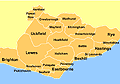
Hastings Area Maps
Pick from the sections below to view the relevant local maps

Hastings & St Leonards Street Map
Find your way around with our complete street map of Hastings and St Leonards with comprehensive A-Z street index and interactive grid navigation.

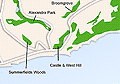
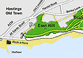
Hastings Country Park
Map of Hastings Country Park. Local nature reserve and large public green space.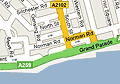
Google Hastings Map
This map from Google offers both street and satellite views of Hastings & St Leonards.

 Sponsored by Stream House Bed & Breakfast